This app delivers accurate, real-time directions with 360-degree street imagery, all while keeping ads to a minimum for a smooth experience. Perfect for hassle-free exploration and travel.
See Where You're Going Before You Go
Preview destinations with street-level imagery, plan smarter routes, and discover nearby places – all in one powerful navigation app that gives you confidence for every journey.
100,000+
Downloads
Everything You Need to Navigate and Explore
1
Preview Any Destination
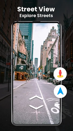
Explore street-level imagery of your destination before you travel. See neighborhoods, landmarks, and routes as if you're already there, so you arrive knowing exactly what to expect and never feel lost in unfamiliar places.
2
Smart Route Planning
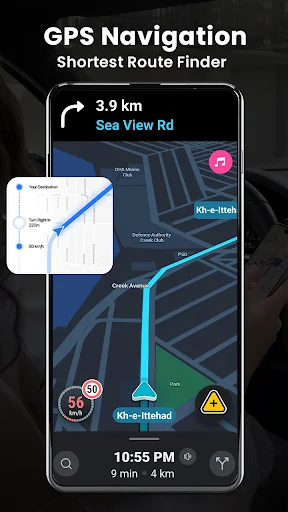
Compare multiple route options for driving, walking, or cycling with real-time traffic information. Get turn-by-turn voice guidance that keeps you on track while traffic-aware suggestions help you avoid delays and reach your destination faster.
3
Multiple Map Perspectives
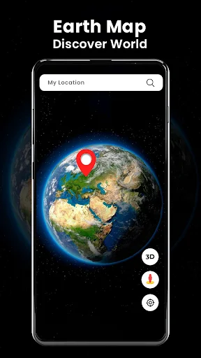
Switch effortlessly between street view, satellite imagery, and 3D maps to get the perfect perspective for your needs. Whether you want a bird's-eye view or ground-level detail, you'll always have the visual context to understand your surroundings completely.
4
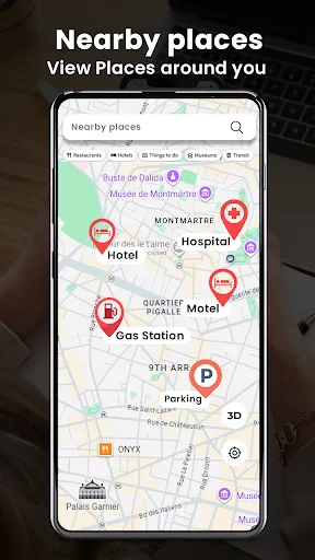
Find Places Nearby
Quickly locate restaurants, gas stations, hospitals, ATMs, and other essential services around your current location or destination. Plan convenient stops along your route and never waste time searching for what you need in an unfamiliar area.
GPS Navigation: Live Street View - Explore Routes, Maps, And Places With Street View Maps!
GPS Navigation: Live Street View helps you plan trips, explore street-level imagery, check your position, and find useful places around you. Whether you are driving, walking, or cycling, the Street View Map App brings route planning and map tools together in one convenient experience.
3D Maps GPS Location Tracker gives you a visual way to explore areas and understand your surroundings. GPS Route Finder App helps you build routes between locations and review available directions before you travel.
Navigation And Map Features:
- Maps Street View App - Explore supported street-level imagery and nearby areas
- GPS Map Navigation App - Check your position and follow available route guidance
- 3D Maps GPS Location Tracker - Explore locations with detailed map views
- Satellite View Live Camera - View available satellite-style map imagery
- GPS Route Finder App - Plan routes for driving, walking, or cycling
- Nearby Places - Find restaurants, hospitals, fuel stations, ATMs, and other useful locations
- Voice Guidance - Follow supported spoken navigation instructions
- Traffic Information - Review available road and traffic conditions when supported
Plan a route, explore the area, and find your way with practical map tools!
Maps Street View App can help you preview supported roads, landmarks, and neighborhoods before visiting them.
GPS Map Navigation App makes it easier to move between your current position and a selected destination.
How To Use:
- Open GPS Navigation: Live Street View and search for a destination
- Allow location access when you want position-based features
- Use GPS Route Finder App to create an available route
- Open Maps Street View App to explore supported street imagery
- Choose Satellite View Live Camera for satellite-style views
- Check nearby places when you need useful services
Route Planning And Directions:
GPS Map Navigation App can help you compare available routes for different types of travel. Select your destination and review the suggested path before you leave.
Explore Locations In Different Views:
3D Maps GPS Location Tracker gives you another way to understand streets, buildings, and surrounding areas. Switch between available map styles depending on whether you want a broader overview or more detailed visual context.
Satellite And Street Exploration:
Satellite View Live Camera provides access to supported satellite-style imagery for exploring locations from above. These map images are not necessarily live camera feeds and may have been captured at an earlier time.
Find Useful Nearby Places:
Search for restaurants, hospitals, fuel stations, ATMs, shops, and other available categories around your location or destination. Street View Map App can make planning stops along your route more convenient.
Traffic And Travel Awareness:
Available traffic information can help you understand current road conditions and possible delays. Route suggestions may change depending on traffic data, map availability, road restrictions, and your selected travel mode.
Location And Navigation Accuracy:
GPS-based features depend on your device sensors, permissions, signal quality, map data, and surrounding conditions. Always follow road signs and local traffic rules rather than relying only on digital navigation.
Explore More And Plan Your Route With Confidence!
GPS Navigation: Live Street View combines route planning, street exploration, nearby-place discovery, map views, satellite imagery, and navigation tools in one practical app for everyday travel.
See How Easy Navigation and Exploration Can Be
Trusted by Travelers and Commuters Everywhere
I love this app and being able to look at places as if I'm standing right there is awesome! 👍
very easy to use. alot more settings than Google maps. I really like it.
best app for Android user to find approximately route finders
I LOVED TO USE THIS OPERATION
street view best app